Back-to-back winter storms hit the East this weekend with arctic blast behind them next week

Two winter storms will move through the East this weekend, with cold air coming right behind it in an arctic blast forecast for next week.
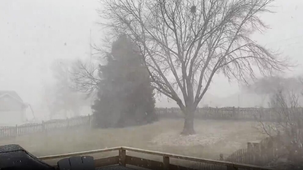
The first of the two storm systems will be a quick-moving, clipper system that continues to bring scattered snow showers to the Midwest and Great Lakes before bringing two rounds of snow for the Northeast and Mid-Atlantic on Saturday.
The first round of snow showers moved through early Saturday morning from the central Appalachian Mountains in West Virginia and Virginia up into Pennsylvania, as well as New England. The next round moves in later Saturday morning.
By noon, there will be either snow or mixed conditions along the I-95 corridor from Baltimore to Philadelphia to New York City.
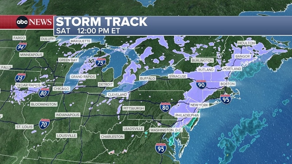

By mid-afternoon, Washington, D.C., to Philadelphia will be clear with New York City and Bridgeport, Connecticut, seeing a change to a light wintry mix as things begin drying up.
Most of New England will see snow on Saturday except along the coast. Boston is likely seeing mostly rain from this, but could get in on a wintry mix at times.
Heading into Saturday night, the first storm system moves out and things begin to clear out across the Northeast, with only a few isolated showers remaining.
The next storm system, which will be a coastal storm that forms off the Southeast coast early Sunday morning, will slide up the East Coast for Sunday.
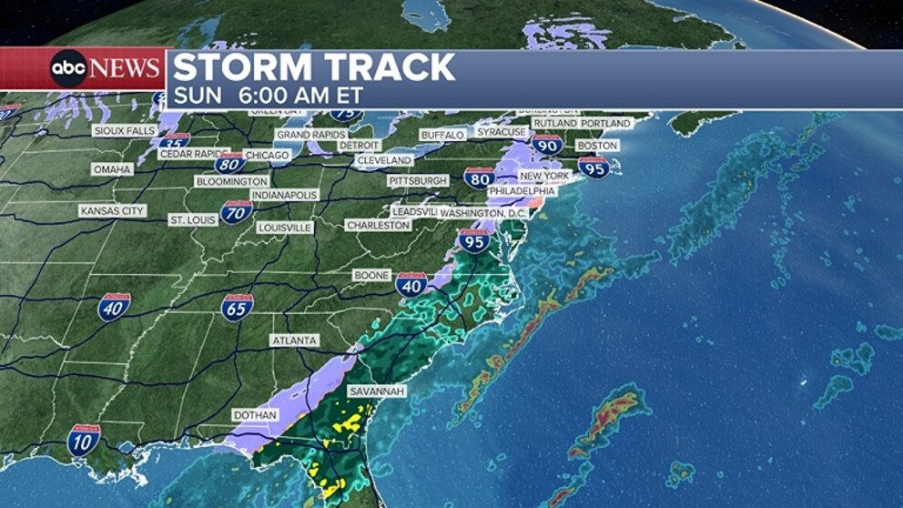
A light wintry mix or snow will be present for parts of Georgia on Sunday morning by 8:00 a.m., with it possibly extending down to the Florida Panhandle. Atlanta could even get in on a few snow showers, while Macon, Georgia, is likely to see more concentrated wintry weather.
Rain elsewhere along the Southeast coast extends up into the Carolinas.

As the coastal storm moves up the East Coast later Sunday morning into the afternoon, the next round of snow looks to develop along the Northeast coast from Washington, D.C., to New York City to Boston.
It’s not set yet who will see snow with this coastal storm, as it all depends on how close it is to the coast. There is a chance for more snow near the I-95 corridor. However, it's becoming clearer that there'll be more snow for areas along the coast rather than areas inland with this second storm system.
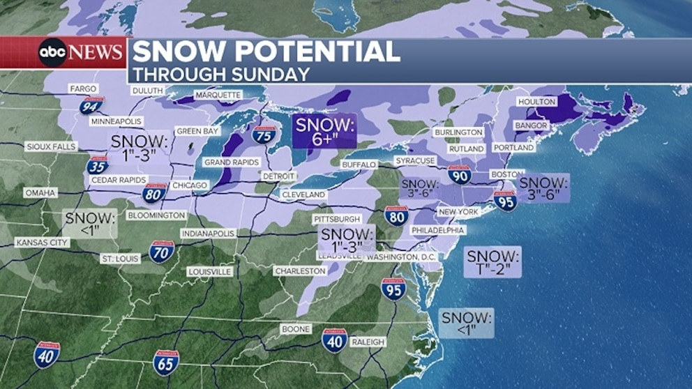
Overall, both of these storm systems will bring minor accumulations along the I-95 corridor and parts of New England.
Some higher snowfall amounts of 2 to 6 inches will be possible north and west of the I-95 corridor and parts of interior New England.
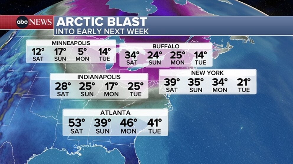
Behind these two systems will be a big arctic blast that will sweep across much of the Eastern and Central U.S. to start the new work week.