Canadian wildfire smoke descends on parts of US, including New York City
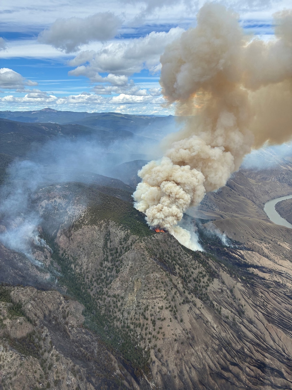
More than 830 wildfires were burning in Canada, along with more than a dozen in northern Minnesota, forcing mandatory evacuations and spreading unhealthy smoke down to the Lower 48.
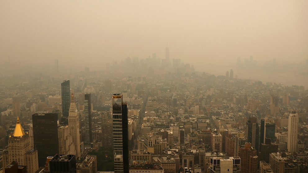
A cloudy orange haze was seen blanketing the spires of buildings that make up New York City's iconic skyline on Wednesday, with poor air quality expected to continue through Thursday.
Officials issued an Air Quality Health Advisory for the entire state on Thursday.
Some of the largest wildfires are burning in west-central Ontario, consuming thick forests and releasing an incredible amount of smoke.
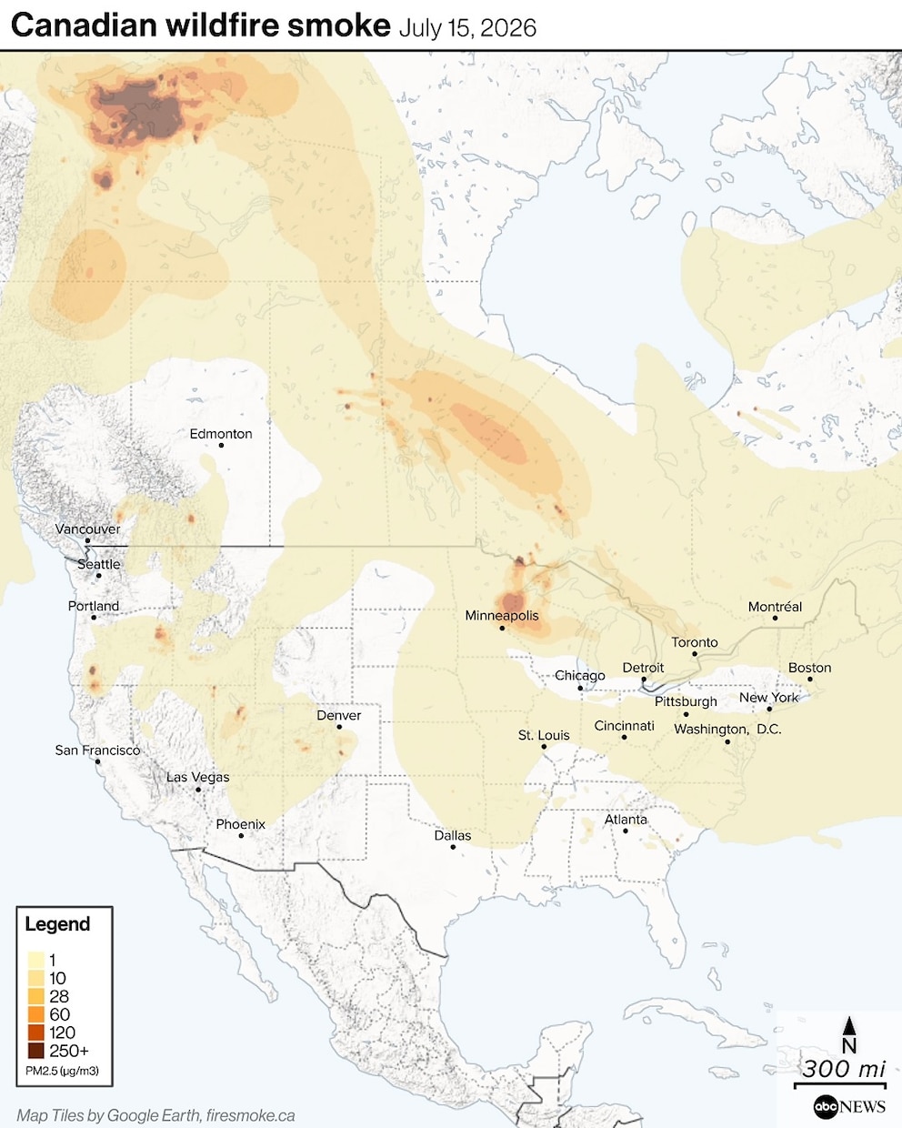
The wind has directed the smoke into the U.S., creating dangerous air quality for millions across the upper Midwest and Northeast on Wednesday and through the end of the week.
On Wednesday afternoon, air quality initially reached unhealthy levels in New York City and the Eastern Lake Ontario region, the Central New York region and parts of Western New York, according to air monitoring site AirNow.
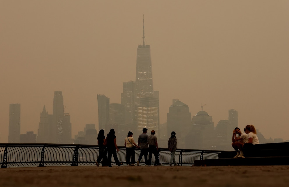
"Air quality has reached unhealthy levels in parts of NYC due to smoke from Canadian wildfires," New York City Mayor Zohran Mamdani said in a social media statement on Wednesday. "Poor air quality affects everyone, but some people are more sensitive to it than others, including people with heart or lung conditions, older adults, pregnant New Yorkers, and infants and children."
Mamdani urged New Yorkers to avoid unnecessary outdoor activities and to stay inside in an air-conditioned setting. He said the city was offering free masks to help people cope with the smoke.
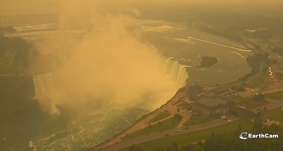
The smoke is coinciding with a coast-to-coast extreme heat spell. Many of the areas in the Northeast and upper Midwest are expected to take the brunt of the Canadian smoke and will see temperatures on Wednesday and Thursday in the high 90s to triple digits.
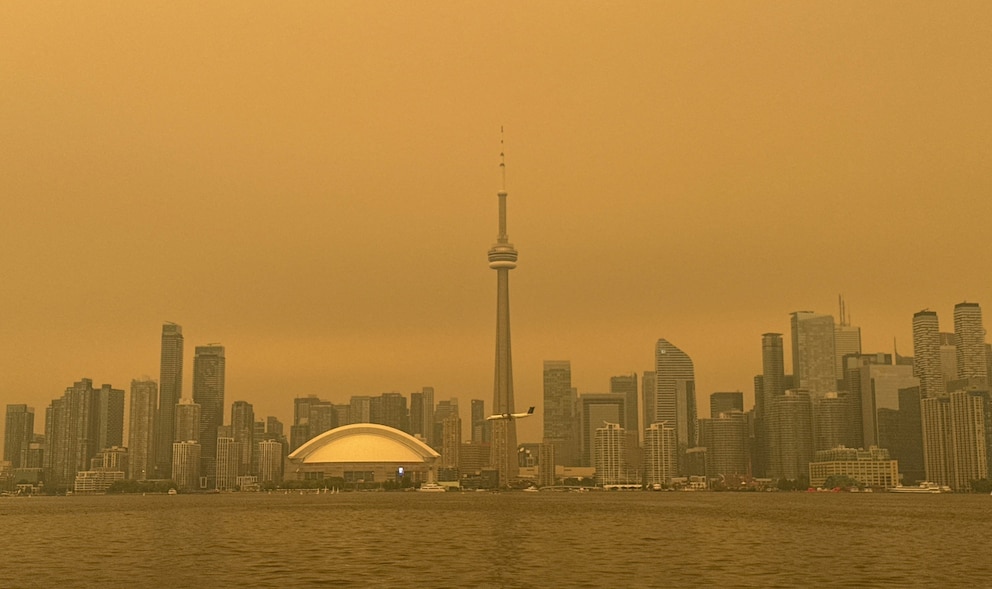
Rain on Friday over the upper Midwest and on Saturday for the Northeast should help disperse some of the smoke.
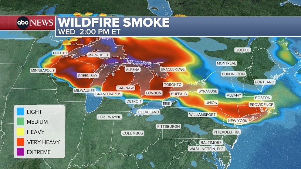
Very heavy smoke is over Duluth, Minnesota, and Marquette, Michigan, on Wednesday morning, and extreme smoke is over northern Wisconsin.
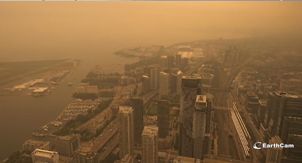
Areas of heavy smoke were sweeping across New York state and New England throughout Wednesday, reaching New York City to Boston later in the day.
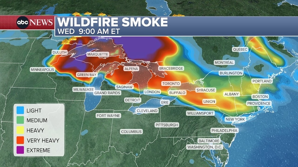
By sunset on Wednesday, the smoke may reach from Buffalo to New York City and Philadelphia -- streaming through Green Bay, Milwaukee, Grand Rapids, Detroit and Toronto.
Conditions in New York City are not expected to be as intense as they were in June 2023 when smoke from the Canadian wildfires turned skies orange.
Hazy skies are expected in New York and air quality will likely become unhealthy.
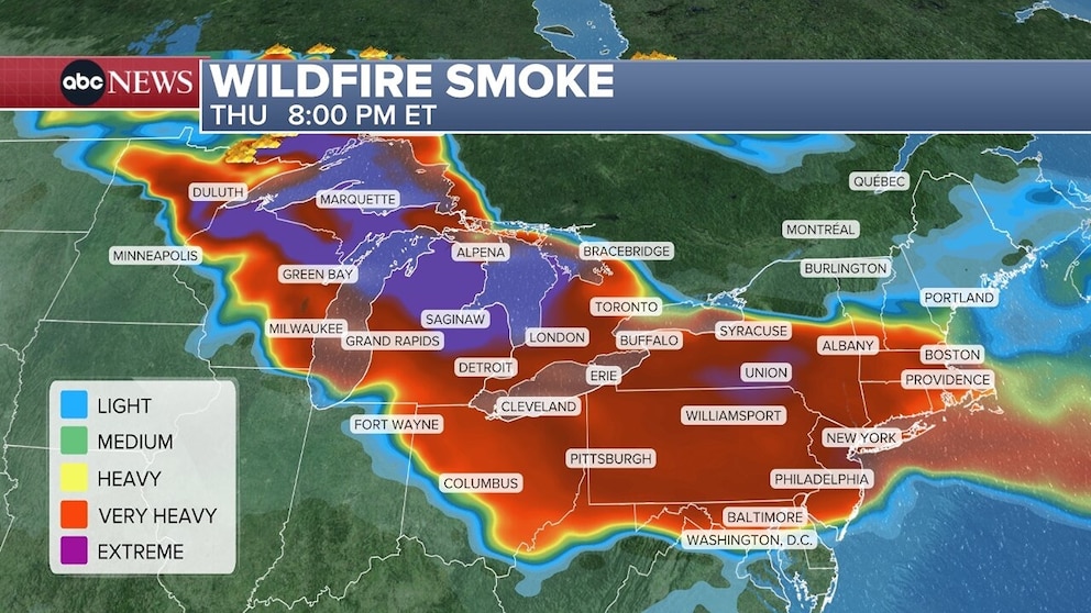
Smoky conditions could, however, be bad on Thursday from Duluth to Green Bay and Marquette, and through much of northern Michigan.
Cleveland, Columbus, Baltimore and Washington, D.C., will likely see heavy smoke on Thursday.
The smoke will be serious for millions and may reach a dangerous level for everyone -- not just those with respiratory issues.
Air quality alerts are in place from Minnesota to New York City, including the entire states of Wisconsin and Michigan.
Dangerous heat continues
Extreme heat is inundating much of the country. Temperatures along the East Coast from Washington, D.C., to New York City could climb to near 100 degrees on Wednesday.
Heat indices, or what the temperature feels like with humidity, will make it feel like 104 degrees in New York City, 105 in the nation's capital, and up to 107 in Philadelphia.
The hottest day of the Northeast heat spell is likely going to be on Wednesday, with cooler temperatures moving from north to south in the coming days.
Minneapolis remains under an extreme heat warning through Thursday, with the heat index there expected to be near 100.
Extreme heat warning issued in Los Angeles
An extreme heat warning was issued in the Los Angeles area on Wednesday and is expected to stay in effect until Thursday night as Southern California temperatures soared into the high 90s and triple digits.
Los Angeles and Orange counties on Wednesday are expected to see a high of 96 degrees and a low of 69. High temperatures are expected to drop to the low-to-mid 80s by Friday and through the weekend.
California's San Joaquin Valley was also expected to hit the century mark on Wednesday, with temperatures in Fresno expected to climb to 104 and to 105 in Bakersfield.
Tornado touches down in Texas as Hill Country flooding continues
Meanwhile, flash flooding is expected to continue in Texas Hill Country, where 6- to-16 inches of rain have already fallen this week, prompting numerous water rescues.
The flooding threat in parts of South-Central Texas is at a rare 4 out of 4 level and an additional 6- to-12 inches of rain are expected in the region, specifically in the cities of Loma Alta, Uvalde and San Antonio. Up to 20 inches of rain iis possible in some local areas.
Multiple witnesses spotted a tornado touch down near San Antonio on Wednesday morning. There were no immediate reports of damage.