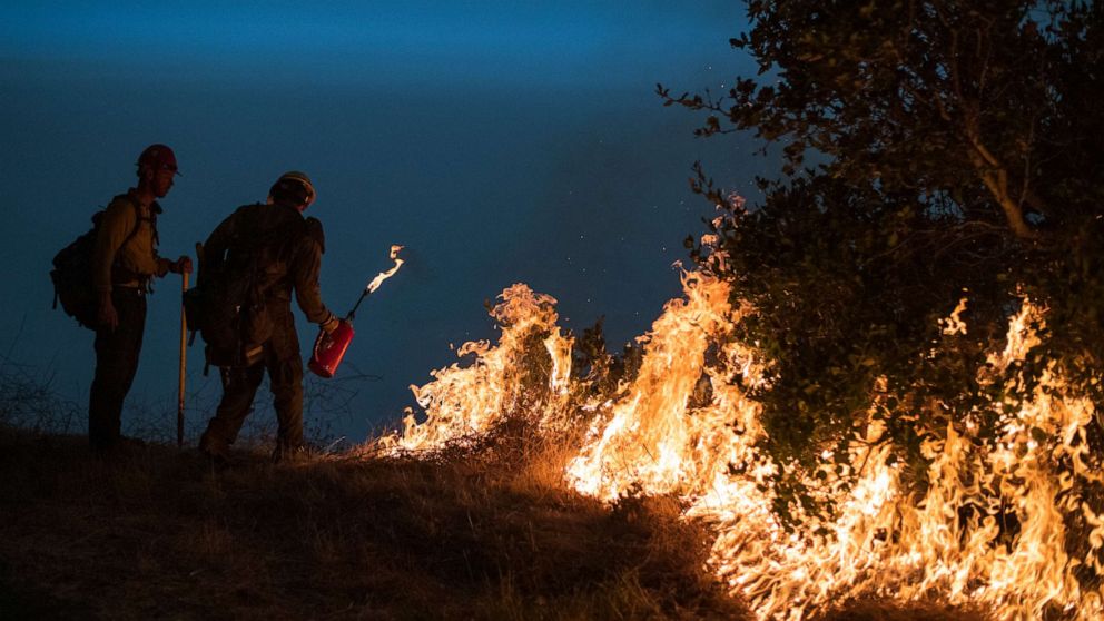
Dangerous fire conditions developing West with Santa Ana winds coming to California
The weather pattern is beginning to turn more conducive for fire development across parts of the Western U.S. once again.
High pressure building over the region will cause temperatures to rise and dry gusty winds to develop over parts of the region, especially California.
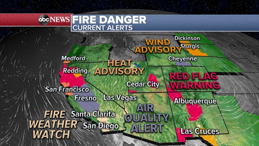
There are fire weather watches and red flag warnings issued for parts of California, Utah and New Mexico due to the increasing dry and windy conditions.
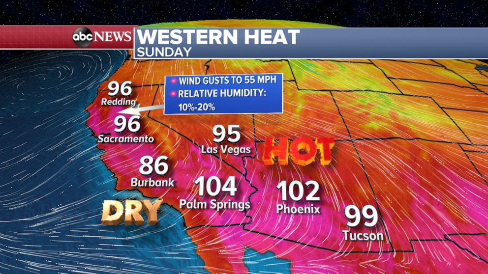
Temperatures today will be in the 90s across interior California and near 100 in parts of Southern California and temperatures should continue to rise across the region over the next several days.
Today, the most critical fire danger will be parts of northern California as well as Southern California, in particular the mountains north of Los Angeles, as the Santa Ana wind event begins.
Tomorrow the same regions will be in critical fire danger with the danger expanding all the way to the mountains outside of San Diego with wind gusts to 45 mph with relative humidity as low as 7% will be possible as the Santa Ana winds will peak tomorrow.
Fire weather conditions will remain elevated through the much of the rest of the week, though the Santa Ana winds are expected to gradually subside.
Meanwhile, on the other side of the nation, a strong cold front will move through from the Midwest to the East Coast on Monday and Tuesday.
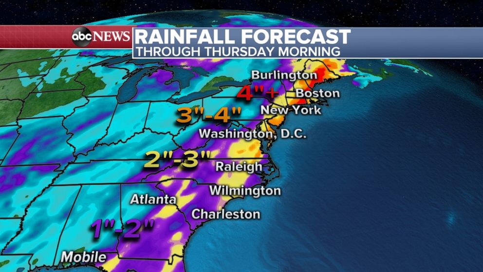
There is increasing potential for widespread heavy rain, possibly capable of producing flash flooding on Tuesday along the East Coast of the U.S., including some of the major metro areas.
Preliminary forecasting shows the potential for over two inches of rain from the Carolinas to New England.
Behind the cold front, much cooler air will sink into the U.S. and by Friday morning widespread wind chills will dominate parts of the central U.S.