Heavy rain ongoing on Gulf Coast as storm aims for Northeast next week
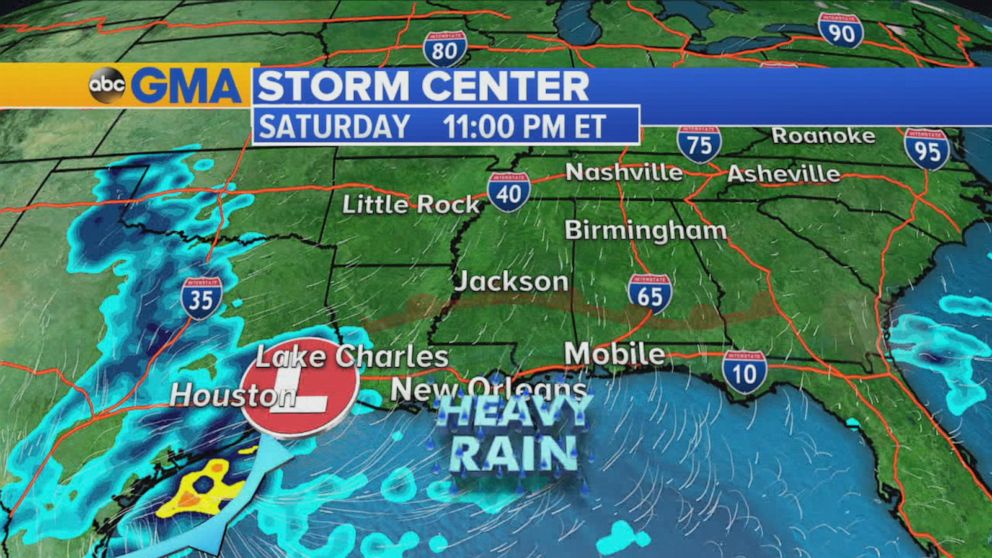
Heavy rain is ongoing along the northern Gulf Coast Saturday morning.
As of Friday evening, several counties reported over 2 inches of rainfall over a 24 hours period, including Polk County, Texas, that saw 3.18 inches and Wharton County, Texas, which saw 4.98 inches of rain.
The frontal boundary is expected to hover over the same area through Sunday, bringing more heavy rainfall in the already-saturated locations.
Localized flooding is expected, along with the potential for some local flash flooding as 3-6 more inches of rain is expected through the weekend in some Gulf Coast locations.
By Sunday afternoon, the system will develop a strong center of low pressure that will get picked up by a jet stream and start quickly moving to the Northeast.
The system hustles into the Northeast with a strong cold front by Monday.
Gusty winds, heavy rain and coastal inundation are expected in some areas of the Northeast and New England by Monday afternoon and evening.
Cold air will rush in on the system's backside across the Great Lakes, bringing the threat for lake effect snow Monday into Tuesday.
The system will bring up to 2 inches of rain to the Northeast, with some very localized areas receiving more.
By early Tuesday, backside snow will drop 3-5 inches in the lake effect Snowbelt region of northwest Pennsylvania and extreme western New York state.
Wind chill values will be in the 30s for parts of the Gulf Coast and in the middle teens for parts of the Midwest Tuesday morning.
The colder air mass eventually reaches the Northeast by late Tuesday into Wednesday, but not before temperatures jump well above normal into the 60s on Monday and Tuesday from Washington D.C. to Boston.
Meanwhile, in Southern California, as people wake up Saturday morning, the area has several weather alerts, including red flag warnings, frost advisories and freeze warnings.
The fire risk will be critical early Saturday before being reduced to elevated later Saturday into Sunday.