Severe weather, flash flood threat impact eastern half of US

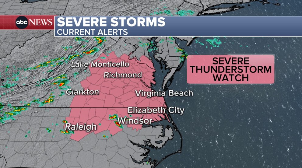
Around 11 million Americans are under flood alerts Saturday evening as a "ring of fire" weather pattern continues to impact the eastern two-thirds of the country through the weekend.
A flash flood emergency was issued near the Washington, D.C., area, including suburban Maryland, such as Chevy Chase and Silver Spring until 9 p.m. ET.
The National Weather Service called it a "particularly dangerous situation" and said flash flooding was already occurring.
Between 3 to 5 inches of rain has already fallen, but additional rainfall amounts between 1 to 2 inches were possible.
Meanwhile, a flood watch was issued for Washington, D.C., until 10 p.m. ET.
Overall, locally heavy downpours associated with showers and thunderstorms will continue to raise concerns in regard to flash flooding.
Plenty of atmospheric moisture and already saturated grounds will only increase the likelihood of flooding and will exacerbate flooding that is ongoing.
Flood watches also remain in effect across portions of Iowa, western Illinois, and northeastern Missouri through Sunday, and for portions of Virginia, and northeastern North Carolina through Saturday night.
Areas under a flood watch could see between 2 to 4 inches of rain.

A number of Flash Flood Warnings are also in effect across portions of southern Illinois, southern Indiana and northern Kentucky, where heavy rain from thunderstorms moved through.
Much of the heavy rainfall and flooding will be localized -- not everywhere will be impacted. However, the potential for heavy rainfall stretches across a good portion of the eastern U.S., which remains under a slight risk for excessive rainfall through tonight.
Between 1 to 3 inches are possible depending on where storms track, but locally higher amounts are possible in some spots.
Portions of western and central Kentucky, southern Indiana and southeastern Illinois have been elevated to a moderate risk -- level 3 of 4 -- for excessive rainfall through Saturday evening. Rainfall totals between 3 to 5 inches are possible, with rainfall rates potentially reaching 2 to 3 inches per hour.
'Ring of fire' weather pattern brings storm risk
Though not a formal meteorological term, a "ring of fire" is an area of high pressure, which typically is a heat dome. Around the periphery of the heat dome, thunderstorms can develop, which is where the name comes from.
High pressure centered over the Southeast will keep dangerously hot and humid conditions in that region, but strong to severe storms along the perimeter of the high will remain possible across portions of the Plains, Midwest and even across portions of the East Coast.
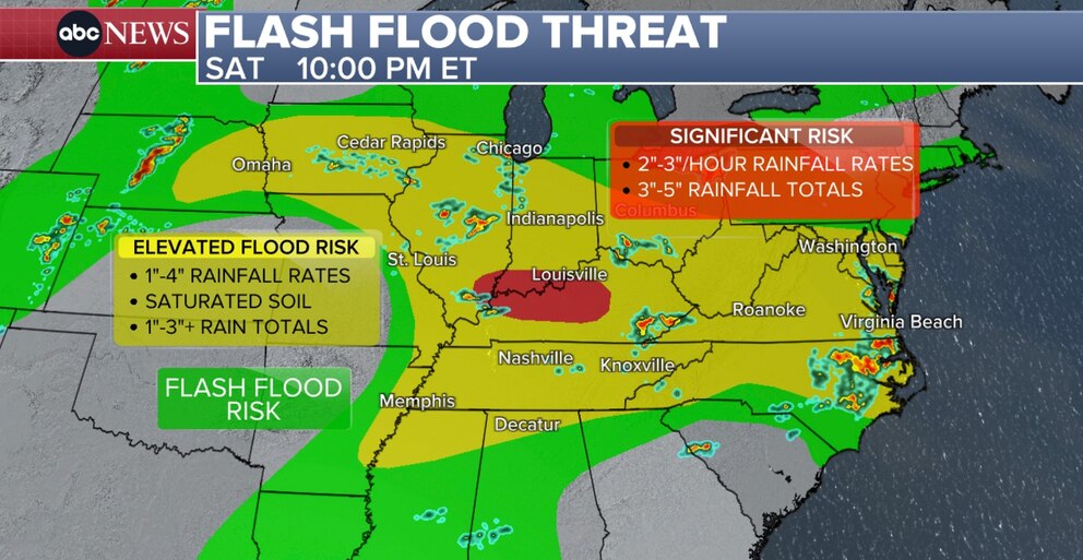
Severe thunderstorm watches remain in effect for portions of southern Maryland, northeastern North Carolina and Virginia until 10 p.m. ET Saturday.
The primary threats include damaging winds, with gusts up to 65 mph possible, and isolated large hail up to an inch in diameter.
To the west, portions of Nebraska remain under a tornado watch until 11 p.m. CT Saturday.
A severe thunderstorm watch is also in effect for portions of eastern Montana, North Dakota, South Dakota and far northeastern Wyoming until 12 a.m. MT. Damaging winds, with gusts up to 70 mph are possible, along with the potential for very large hail measuring as much as 2.5 inches in diameter.
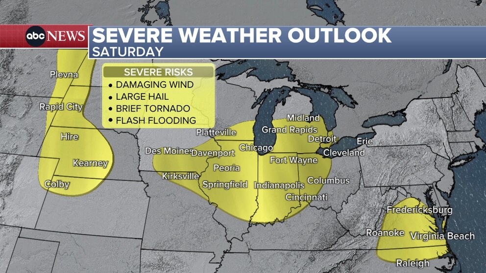
Over 13 million across 13 states are under a slight risk -- level 2 of 5 -- for severe weather through the night.
Damaging winds and the potential for flash flooding remains a threat for all areas, but powerful storms that develop over parts of the Plains and Midwest could generate large to very large hail and even a few tornadoes.
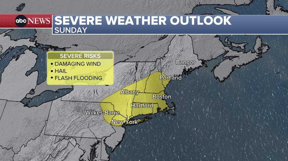
While parts of the Dakotas are under a slight risk for severe weather on Sunday, parts of Northeast could also encounter strong to severe storms as well. This includes big cities like New York City, Boston and Albany -- which are all under a slight risk, mainly for damaging winds and the potential for hail.